


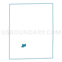
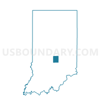
HENSLEY 03, Johnson County, Indiana
About
Outline

Summary
| Unique Area Identifier | 578074 |
| Name | HENSLEY 03 |
| County | Johnson County |
| State | Indiana |
| Area (square miles) | 1.04 |
| Land Area (square miles) | 1.04 |
| Water Area (square miles) | 0.00 |
| % of Land Area | 100.00 |
| % of Water Area | 0.00 |
| Latitude of the Internal Point | 39.41357920 |
| Longtitude of the Internal Point | -86.15255430 |
Maps

Graphs
Select a template below for downloading or customizing gragh for HENSLEY 03, Johnson County, Indiana


Neighbors
Neighoring Voting District (by Name) Neighboring Voting District on the Map
- HENSLEY 01, Johnson County, IN
- HENSLEY 02, Johnson County, IN
- NINEVEH 03, Johnson County, IN
- NINEVEH 04 (NV), Johnson County, IN